Talk to your map data. Instantly.
Leeana is the GIS AI workspace that lets you run geospatial checks with confidence and at scale

Making complex spatial analysis fast and simple
Environment
Screen protected areas, map baselines, and deliver consistent, audit-ready outputs
Energy & Infrastructure
Site renewable and BESS projects, assess land-use constraints, and avoid costly permitting delays
Development
Check zoning, environmental buffers, and compliance risks early in the planning process
From raw map data to structured output in minutes
Bring your own or use built-in maps
Start with your own spatial data or jump right in with Leeana’s high-quality native layers - no setup needed
Run spatial checks in plain language
Just type what you need, like “check overlap with protected areas” or “find the closest substation to this node”. Leeana AI selects the right tools automatically.
Export, share, or keep collaborating
Save results in the platform, visualize them on maps, or export for reporting - your team picks up where you left off
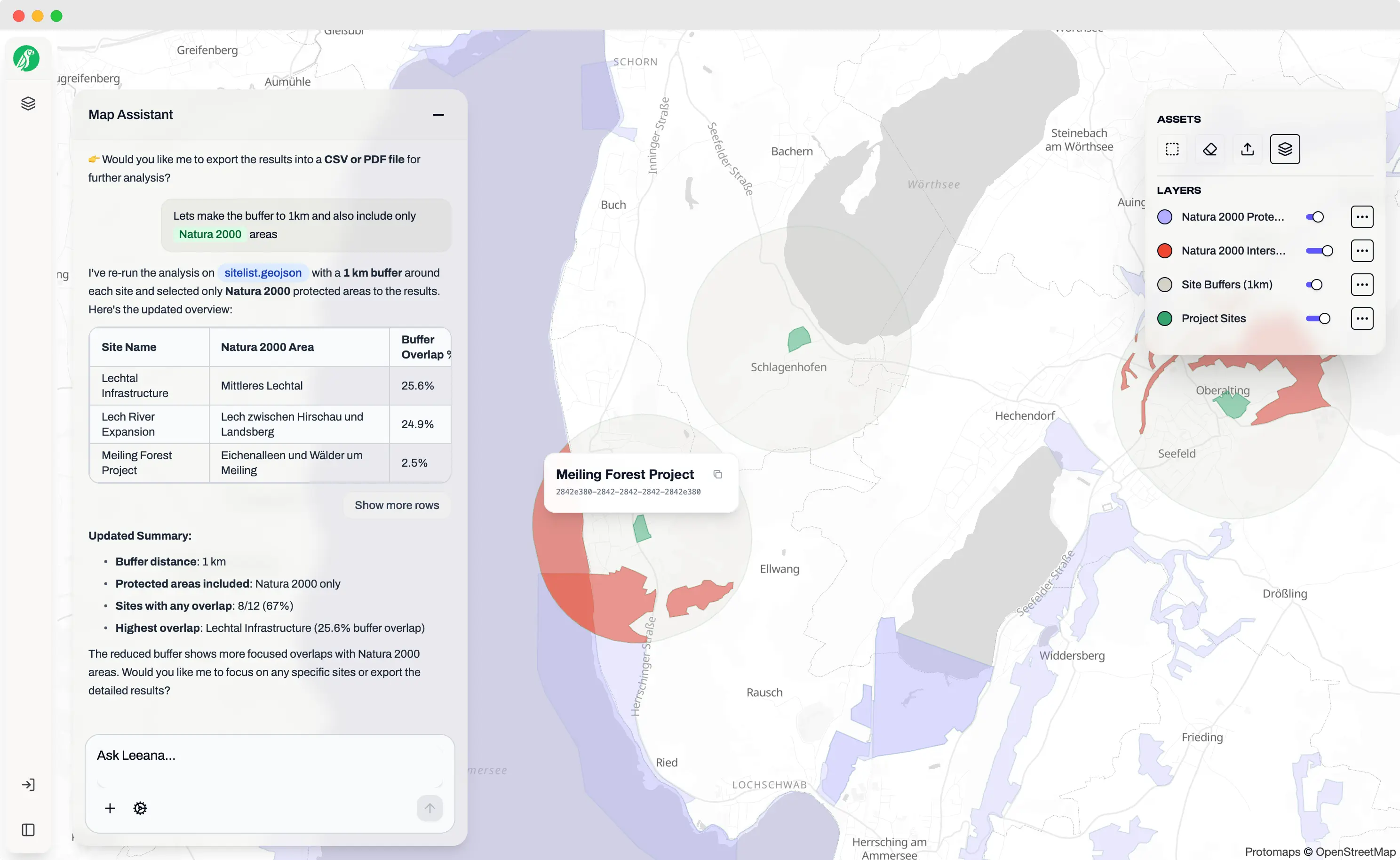
Protected area checks - done in seconds
Leeana AI comes with its own curated database of protected and biodiversity-sensitive areas, so you can upload your sites, define buffers, and instantly check overlaps
Playbooks built for your needs
Ready-made workflow bundles that deliver consistent, audit-ready results
EIA Pre-Screening
Bundle biodiversity, flood risk, and land-use checks into one fast, audit-ready assessment
CSRD / ESRS Reporting
Generate site-level spatial data and standardized outputs aligned with CSRD and ESRS requirements
Renewable Site Suitability
Evaluate wind and solar locations against protected areas, zoning rules and environmental buffers. Identify viable sites early and reduce permitting risk.
BESS Opportunity Screening
Identify high-value battery storage locations by combining grid signals, node and zone prices, proximity factors and land-use constraints
The smarter way to do geospatial
Why teams rely on Leeana instead of manual, repetitive GIS work
Self-Serve
A simple chat makes it usable for non experts
Audit-Ready
Every result comes with a transparent evidence trail
Reduce Risks
Faster checks at scale avoid costly delays
Plug & Play
Start with curated native spatial layers - instantly